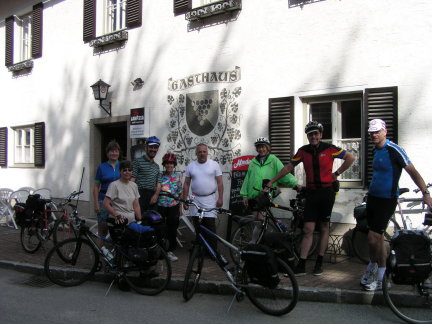
DAY 9: Ardagger Stift to Göstling an der Ybbs (34 miles + train
When we turned south away from the Danube we entered a region known as the "Mostviertel", a term coined by the tourist establishment for the area in Lower Austria between the Danube and Alps and west of the Vienna Woods. Viertel literally means quarter (as in French Quarter), but can be translated as region or district. "Most" is German for hard cider which is produced from pears and apples grown in the area. The northern half, i.e., nearest to the Danube is rolling farmland; whereas the southern half is the much more hilly Alpine foothills. A characteristic feature of the area is large farm buildings called vierkanterhof's, literally "4 cornered farm house". It has four sides with a courtyard in the center. One side is the home; and the other three house animals and machinery.
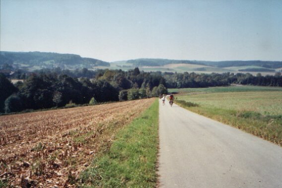
Rolling farmland of the Mostviertel (this photo was taken in 2003)
Rolling farmland of the Mostviertel (this photo was taken in 2003)
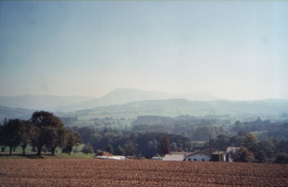
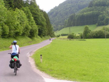
Mostviertel with Alpine foothill in background
Mostviertel with Alpine foothill in background
The first leg of today's journey continued the climb begun the day before and ended with a long downhill into Amstetten, a total distance of only 3 miles. The second was an hour long train ride south along the Ybbs to Waidhofen an der Ybbs, a fascinating town known as the city of towers. The train was part of the plan in order make the detour fit into the schedule, and also because we had ridden the route from Ybbs an der Donau to Waidhofen an der Ybbs in 2003.
The first leg of today's journey continued the climb begun the day before and ended with a long downhill into Amstetten, a total distance of only 3 miles. The second was an hour long train ride south along the Ybbs to Waidhofen an der Ybbs, a fascinating town known as the city of towers. The train was part of the plan in order make the detour fit into the schedule, and also because we had ridden the route from Ybbs an der Donau to Waidhofen an der Ybbs in 2003.
Waidhofen an der Ybbs, the "city of towers", as seen from the Ybbs River Bridge. How many can you spot?
Waidhofen an der Ybbs, the "city of towers", as seen from the Ybbs River Bridge. How many can you spot?
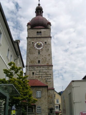
One of the towers in Waidhofen an der Ybbs. Inscription on this one indicates it is dedicated to farmers, townsmen, and forge workers who drove out the Ottoman Turks in the 1600's.
One of the towers in Waidhofen an der Ybbs. Inscription on this one indicates it is dedicated to farmers, townsmen, and forge workers who drove out the Ottoman Turks in the 1600's.
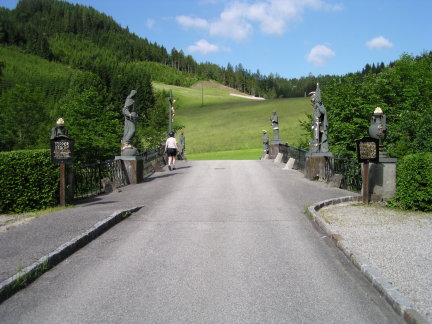
Schloss Rothschild, Waidhofen an der Ybbs. It was originally owned by the Bishop of Freising, Bavaria and was purchased by Baron Rothschild in the 19th century.
Schloss Rothschild, Waidhofen an der Ybbs. It was originally owned by the Bishop of Freising, Bavaria and was purchased by Baron Rothschild in the 19th century.
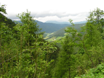
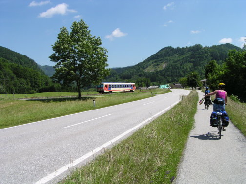
After lunch and a little sightseeing we set off on the 31 mile third leg, following the Ybbs Valley Bike Route (Ybbstalweg) to our next overnight: Göstling an der Ybbs. From this point on the terrain changes: the valley is narrower, the hillsides steeper, and the farms smaller. For 2/3 of the way we ride on the main and only road, which is not a problem because there is little traffic. When the valley widens a bit, the route follows side roads. We also begin following the route of a narrow gauge railroad knows as the Ybbstalbahn. After about 15 miles the route makes a turn toward the east.
After lunch and a little sightseeing we set off on the 31 mile third leg, following the Ybbs Valley Bike Route (Ybbstalweg) to our next overnight: Göstling an der Ybbs. From this point on the terrain changes: the valley is narrower, the hillsides steeper, and the farms smaller. For 2/3 of the way we ride on the main and only road, which is not a problem because there is little traffic. When the valley widens a bit, the route follows side roads. We also begin following the route of a narrow gauge railroad knows as the Ybbstalbahn. After about 15 miles the route makes a turn toward the east.
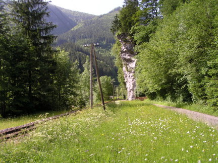
Along the Ybbstalweg.
Along the Ybbstalweg.
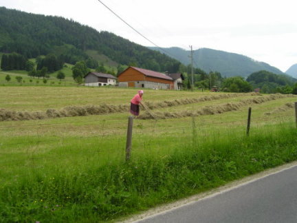
Small farm along the Ybbstalweg. The hay was probably cut with a small tractor.
Small farm along the Ybbstalweg. The hay was probably cut with a small tractor.
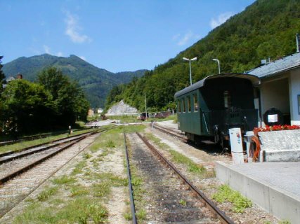
Ybbstalbahn narrow gauge train with bicycle car returning to Waidhofen and der Ybbs from Lunz am See, a resort town on an Alpine lake In this case the bike car had been used to reposition rental bikes, i.e., return them to Lunz am See. Bikes can be rented from one station and returned to another.
Ybbstalbahn narrow gauge train with bicycle car returning to Waidhofen and der Ybbs from Lunz am See, a resort town on an Alpine lake In this case the bike car had been used to reposition rental bikes, i.e., return them to Lunz am See. Bikes can be rented from one station and returned to another.
So far so good. Although we had gone upstream into the Alps, the 525 feet change in altitude from Waidhofen to Göstling was imperceptible. We stayed here for two nights at a gasthof (combination restaurant and lodging) in the center of town. So, despite being surrounded by steep hills, we didn't have to climb to our lodging. Because it was ruhetag (kitchen closed), the owner served us what is called a "tourist menu" in some countries. It started with schnapps, then salad, then Wiener schnitzel and potatoes, and strawberries for dessert. All for 6 Euros (the Euro, once under a dollar, was at this time about $1.21). DAY 10: Layover in Göstling an der Ybbs
Today was spent resting, shopping, and taking side trips. Göstling's attraction is Hochkar mountain and ski area about 8 miles south, and was my favorite overnight.
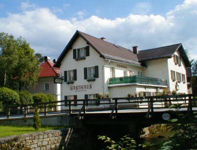
Gastehaus Harich; our home in Göstling. After supper the owner invited us to watch him feed the fish in the stream below with day-old Kaiser rolls.
Gastehaus Harich; our home in Göstling. After supper the owner invited us to watch him feed the fish in the stream below with day-old Kaiser rolls.
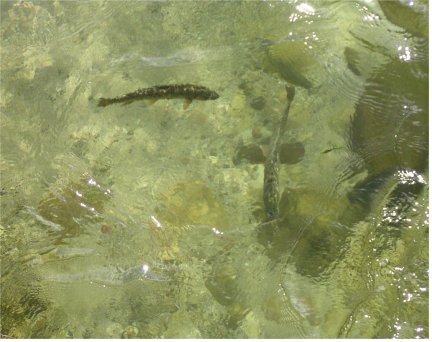
I can spot at least 2 large trout that went for the Kaiser rolls.
I can spot at least 2 large trout that went for the Kaiser rolls.
Austrian National Forest office in Göstling
Austrian National Forest office in Göstling
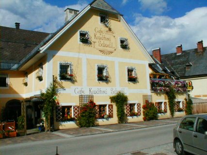
A Cafe-Konditorei in Göstling
A Cafe-Konditorei in Göstling
Passage way between church and parish office in Göstling
Passage way between church and parish office in Göstling
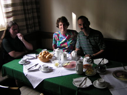
Breakfast at Gastehaus Harich in Göstling. The typical Austrian breakfast consists of Kaiser rolls and hearty bread, cold cuts such as ham and salami, various preserves, and sometimes soft boiled eggs. The highlight, however, is the coffee. Compared to Austrian coffee, Starbucks tastes weak and bitter.
Breakfast at Gastehaus Harich in Göstling. The typical Austrian breakfast consists of Kaiser rolls and hearty bread, cold cuts such as ham and salami, various preserves, and sometimes soft boiled eggs. The highlight, however, is the coffee. Compared to Austrian coffee, Starbucks tastes weak and bitter.
On the way up to Hochkar. While the rest were shopping, my brother and I decided to ride up to the bottom of the aerial tramway at the Hochkar ski area. It was an easy 5 mile climb to the small town of Lassing. However, the rest of the way was the longest, steepest climb I had ever seen.
On the way up to Hochkar. While the rest were shopping, my brother and I decided to ride up to the bottom of the aerial tramway at the Hochkar ski area. It was an easy 5 mile climb to the small town of Lassing. However, the rest of the way was the longest, steepest climb I had ever seen.
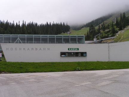
So-called "Valley Station", i.e., bottom, of the aerial tram at the Hochkar ski area. I quit about a third of the way up; but my brother made it as the picture attests.
So-called "Valley Station", i.e., bottom, of the aerial tram at the Hochkar ski area. I quit about a third of the way up; but my brother made it as the picture attests.
Ski lodge at Hochkar closed for the Summer.
Ski lodge at Hochkar closed for the Summer.
DAY 11:Göstling an der Ybbs to Melk (48 miles)
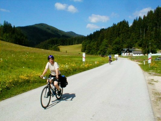
The last 7 miles of the Ybbstalweg took us in a northeastward direction on a bike path to Lunz am See. Lunz is situated on Lunzer See, an Alpine lake which is the source of the Ybbs. Despite going upstream, the gain in altitude was again imperceptible.
DAY 11:Göstling an der Ybbs to Melk (48 miles)
The last 7 miles of the Ybbstalweg took us in a northeastward direction on a bike path to Lunz am See. Lunz is situated on Lunzer See, an Alpine lake which is the source of the Ybbs. Despite going upstream, the gain in altitude was again imperceptible.
Getting ready to leave Gastehaus Harich. Between the owner and Jeanine is the chalk board listing the specials of the day.
Getting ready to leave Gastehaus Harich. Between the owner and Jeanine is the chalk board listing the specials of the day.
Crossing the Ybbs just upstream from Göstling
Crossing the Ybbs just upstream from Göstling
Bike path and narrow gauge Ybbstallbahn between Göstling and Lunz am See.
Bike path and narrow gauge Ybbstallbahn between Göstling and Lunz am See.
Bridge across the Ybbs Rivers near Lunz am See. Its design was not signed off by the ACLU. Mary on the left and St. Florian on the right are identifiable; and one of the other statues is certainly St. John Nepomok.
The sign indicates that the bridge was built by the owner of the largest iron working plant in the area.
As we entered Lunz am See we spotted the start of the Ötscherlandweg which takes us north along the Erlauf river back to the Danube. Since we still had 40 miles to go, we decided to proceed without looking for the lake, Lunzer See, the source of the Ybbs. The question was: how bad was the hill between the source of the Ybbs and the Erlauf? We lost our SAG wagon between Lunz and Gaming because, although the narrow gauge railroad continued to follow us, only week end excursion trains (nostalgiebahn) ran over this section. It turned out to be an easy 3 mile uphill to the small village of Pfaffenschlag, followed by a 4 mile long steep downhill into Gaming.
As we entered Lunz am See we spotted the start of the Ötscherlandweg which takes us north along the Erlauf river back to the Danube. Since we still had 40 miles to go, we decided to proceed without looking for the lake, Lunzer See, the source of the Ybbs. The question was: how bad was the hill between the source of the Ybbs and the Erlauf? We lost our SAG wagon between Lunz and Gaming because, although the narrow gauge railroad continued to follow us, only week end excursion trains (nostalgiebahn) ran over this section. It turned out to be an easy 3 mile uphill to the small village of Pfaffenschlag, followed by a 4 mile long steep downhill into Gaming.
Passing through Pfaffenschlag on the Ötscherlandweg at the high point between the Ybbs and Erlauf river valleys.
Passing through Pfaffenschlag on the Ötscherlandweg at the high point between the Ybbs and Erlauf river valleys.
Because of the relatively long 47 mile day and because several wanted to visit the famous Benedictine Abbey at Melk, four of the group decided to take the train the rest of the way from Kiensberg-Gaming. After installing them and their bikes on the self-propelled diesel car (triebwagen) used on this remote branch line, we continued north on the Ötscherlandweg. Its first segment went downhill to Purgstall an der Erlauf on a bike path, and then along small farm roads through the rolling hills of the Mostviertel back to the Danube at Pöchlarn. A right turn onto the levee alongside the Danube took us the last 7 miles to Melk.
Because of the relatively long 47 mile day and because several wanted to visit the famous Benedictine Abbey at Melk, four of the group decided to take the train the rest of the way from Kiensberg-Gaming. After installing them and their bikes on the self-propelled diesel car (triebwagen) used on this remote branch line, we continued north on the Ötscherlandweg. Its first segment went downhill to Purgstall an der Erlauf on a bike path, and then along small farm roads through the rolling hills of the Mostviertel back to the Danube at Pöchlarn. A right turn onto the levee alongside the Danube took us the last 7 miles to Melk.
Kienberg-Gaming train station. The coach is from the narrow gauge Nostalgiebahn which runs south from here to Lunz am See. The tracks to the left are the standard gauge branch line that runs north from here to the Danube at Pochlarn where it connects with the main east-west line between Vienna and Salzburg.
Kienberg-Gaming train station. The coach is from the narrow gauge Nostalgiebahn which runs south from here to Lunz am See. The tracks to the left are the standard gauge branch line that runs north from here to the Danube at Pochlarn where it connects with the main east-west line between Vienna and Salzburg.
The standard gauge triebwagen (self-propelled diesel rail car) catches up with us north of Kienberg-Gaming along the Ötscherlandweg .
The standard gauge triebwagen (self-propelled diesel rail car) catches up with us north of Kienberg-Gaming along the Ötscherlandweg .
St. John Nepomok statue on bridge across the Erlauf in Scheibs. He must be the patron saint of bridges. ACLU take note.
St. John Nepomok statue on bridge across the Erlauf in Scheibs. He must be the patron saint of bridges. ACLU take note.
Back on the Danube levee. The famous Melk monastery is ahead in the background.
Back on the Danube levee. The famous Melk monastery is ahead in the background.
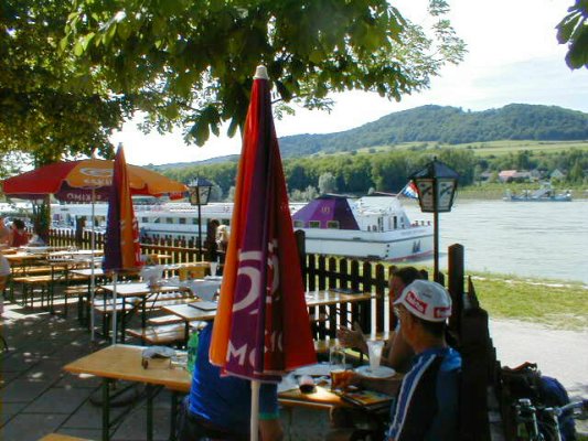
After the 47 miles we figured we deserved a stop at a radlertreff at the turn-off into Melk. A radlertreff (slang for "bicyclist meeting point") refers to snack bars located along bike paths. Actually, this one is more elegant than most because it is located at a boat dock where coaches drop off tourists for cruises on the Danube.
After the 47 miles we figured we deserved a stop at a radlertreff at the turn-off into Melk. A radlertreff (slang for "bicyclist meeting point") refers to snack bars located along bike paths. Actually, this one is more elegant than most because it is located at a boat dock where coaches drop off tourists for cruises on the Danube.
Radlertreff at the turn-off into Melk. The cruise ship is from the Netherlands.
Radlertreff at the turn-off into Melk. The cruise ship is from the Netherlands.